ELEGANTE CRATER, PINACATE
El Elegante is the largest crater in
the Pinacate volcanic field, 1,400 metres wide and 140
metres deep. The crater was formed by a violent volcanic
eruption when rising magma encountered groundwater,
producing highly pressurized steam. This caused large
rocks to be projected onto the surrounding land, and
smaller fragments (cinder) to be dispersed widely over
what is now the current desert floor.
After its eruption, the volcanic cone
collapsed back into the earth, leading to the formation
of a crater. Signs of this collapse can be seen around
the crater rim, where the rock layers are stepped (see
images below).
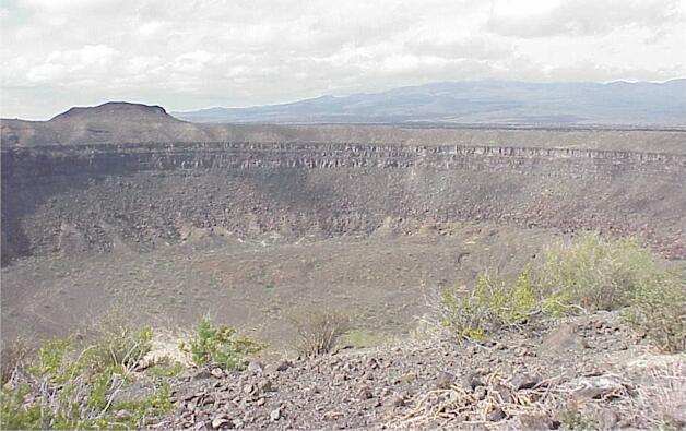
Part of El Elegante crater, seen from the crater rim.
Creosote bushes and other plants are seen in the
foreground.
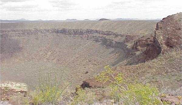
Part of El Elegante crater showing stepped layers where
the rocks have slipped back into the volcanic core. The
lowest part of the crater is seen at the extreme bottom
left of this image (green and white area, coloured by
salt deposits and salt-tolerant plants). The rock outcrop
(extreme right) is part of the core of an earlier
volcano.
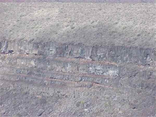
Close up view of rock layers at the crater rim. The
banding pattern represents successive lava flows over
geological time, before the latest eruption caused the
cone tp collapse. Between the lava old layers (basalt)
are bands of "tuff" (compacted red-coloured
volcanic ash).
GO TO:
Pinacate Thumbnail
images?
Pinacate Volcanic
Field: space radar image?
El Elegante crater?
Elegante crater rim?
"Bombs and cinders"?
Colorado crater?
Lava fields?
Pinacate desert floor?
Pinacate campsite?
Pinacate plants?
Pinacate playa?
Lava plants?
Pinacate desert wash?
|